|
| Jiuzhaiguo |
Couple of years ago, we went to Jiuzhaiguo (九寨沟) and we found Paradise there. The scenery is so beautiful that we thought we were in Paradise, at least in my opinion, this place is extraordinary, not from this world. The landscapes, the waterfalls, the many lakes with clear and colourful water, water features and the surroundings, they look so different from all other places I have visited. This place is unique and in a class of its own.No wonder the 6-star hotel there is also called Jiuzhai Paradise.
Jiuzhaigou iterally means "Valley of Nine Villages" is a nature reserve and national park located in northern Sichuan province of south western China. Jiuzhaigou is part of the Min Mountains on the edge of the Tibetan Plateau and stretches over 72,000 hectares (180,000 acres). It is known for its many multi-level waterfalls, colorful lakes, and snow-capped peaks. Its elevation ranges from 2,000 to 4,500 metres (6,600 to 14,800 ft). Jiuzhaigou Valley was inscribed by UNESCO as a World Heritage Site in 1992 and a World Biosphere Reserve in 1997.
 |
| Lake in blue hue |
Jiuzhaigou can be difficult to access by land. The majority of tourists reach the valley by a 10-hour bus ride from Chengdu along the Minjiang River canyon, prone to occasional minor rockslides and in the rainy season, mudslides that can add several hours to the trip. For our trip to Jiuzhaiguo, we flew to Chengdu, then we took a local flight directly to Jiuzhai Huanglong Airport on a 11,311 ft (3,448 m) high mountain side near Songpan County, and then a 90-minute bus ride to Jiuzhaigou. This was before the May-2008 earthquake that rocked the region. The highway that had been badly damaged during earthquake has now been repaired. Further repairs from Mao Xian to Chuan Zhu Si are still ongoing but the road is open to public buses and private vehicles. Due to the large number of tourists that come to this place, more flights have been added daily from Chengdu, Chongqing, Xi'an, Beijing, Shanghai and Hangzhou. Since opening, tourist activity has increased every year: from 5,000 in 1984 to 170,000 in 1991, 160,000 in 1995, to 200,000 in 1997, including about 3,000 foreigners. Visitors numbered 1,190,000 in 2002. As of 2004[update], the site receives an average of 7,000 visitors per day, with a quota of 12,000 being reportedly enforced during high season to ensure minimum damage to the environment of the region.
Jiuzhaigou's landscape is made up of high-altitude karsts (landscapes formed from the dissolution of soluble rocks including limestone, dolomite and gypsum) shaped by glacial, hydrological and tectonic activity. It lies on major fault lines on the diverging belt between the Qinghai-Tibet Plate and the Yangtze Plate, and earthquakes have also shaped the landscape. The rock strata is mostly made up of carbonate rocks such dolomite as well as some sandstone. The valley includes the catchment area of three gullies (which due to their large size are often called valleys themselves), and is one of the sources of the Jialing River, part of the Yangtze River system.
Jiuzhaigou's best-known feature is its dozens of blue, green and turquoise-coloured lakes. The local Tibetan people call them "Haizi" in Chinese, meaning "son of the sea". Originating in glacial activity, they were dammed by rockfalls and other natural phenomena, then solidified by processes of carbonate deposition. Some lakes have a high concentration of calcium carbonate, and their water is very clear so that the bottom is often visible even at high depths. The lakes vary in colour and aspect according to their depths, residues, and surroundings. Some of the less stable dams and formations have been artificially reinforced, and direct contact with the lakes or other features is forbidden to tourists. Some tourists come to this place during the four seasons of the year to enjoy the views of different seasons. Generally, the best time to come to Jiuzhaiguo is during late October period where the plants and flowers blossom and the whole region becomes very colourful. In winter, everywhere is covered with snow, again if you don't mind the cold. The view can be spectacular.
 |
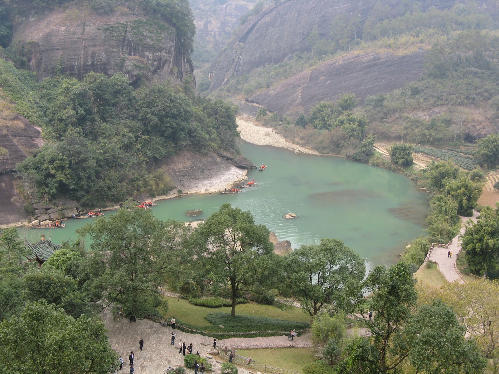
| Scenic view of Jiuzhaiguo |
 |
| Jiuzhaiguo |
 |
| Shuzheng Village, the busiest Tibetan village in the valley |
 |
| Scenic view of waterfall |
 |
| Calcite ponds |
 |
| Plenty of water in this region |
The ponds in little Huanglong with its distinctive brownish colour of calcite deposits.
The water in the lake in Jiuzhaiguo is so clear that you can see the things that are submerged underneath the water.
 |
| Clear water in Lake |
 |
| Black panda |
 |
| The black panda |
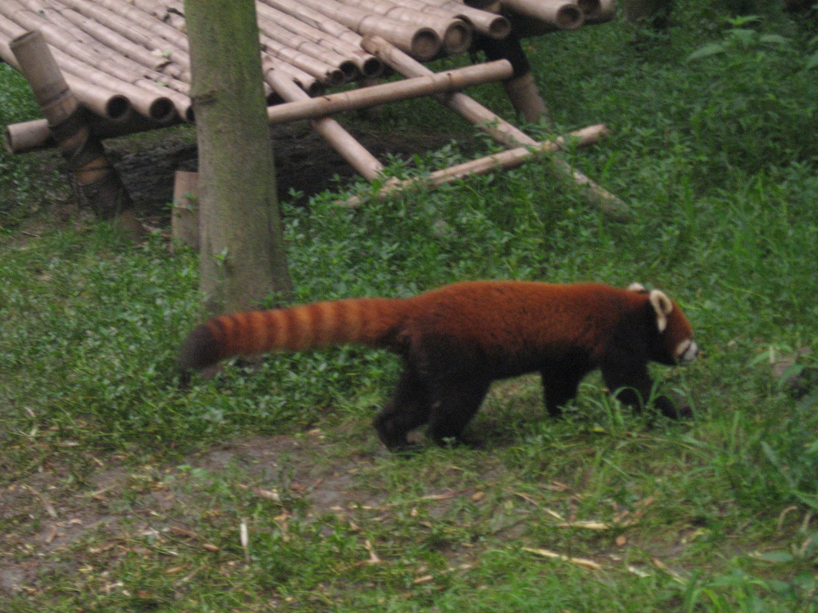 |
| The red panda |